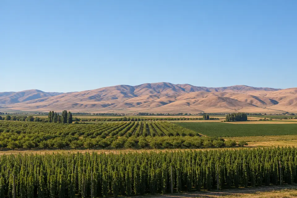
November in Yakima
Typical month, 1991 to 2020
- Average high
- 48.7°F
- Average low
- 27.2°F
- Average rainfall
- 0.85 in
Yakima, Washington
Weather, monthly averages and records.
Thursday : 0.34 in of precipitation in Yakima, WA, the wettest 19 November since 2024, 4th wettest of 81.
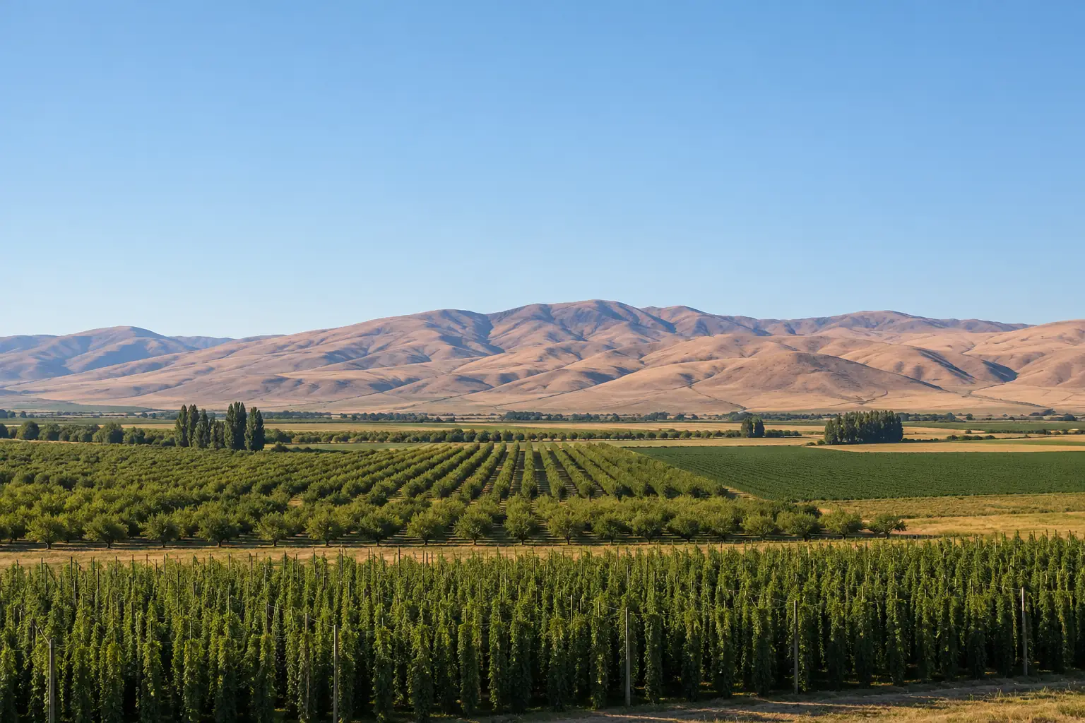
The high of 42°F on Thursday 19 November 2026 in Yakima, WA was 5.2°F below the average high for the date (47.2°F), colder than 75 of every 100 days at this time of year (1991 to 2020). The low of 30°F on Thursday 19 November 2026 in Yakima, WA was 1.7°F above the average low for the date (28.3°F), warmer than 58 of every 100 nights at this time of year (1991 to 2020).
The average 19 November in Yakima, WA (1991 to 2020): a high of 47.2°F, and eight years in ten between 36.7°F and 58.1°F; a low of 28.3°F, and eight years in ten between 15°F and 38°F.
A high of 42°F or less on 19 November has happened in 26 of 81 years at the Yakima, WA station, 2026 included; the last time before 2026 was 2024. A low of 30°F or more on 19 November has happened in 34 of 81 years at the Yakima, WA station, 2026 included; the last time before 2026 was 2019.
At the Yakima, WA station on 19 November: record high 69°F (1962), record low 4°F (1985).
1 January to 19 November 2026 averaged 54.4°F in Yakima, WA, 1.1°F above the 1991 to 2020 average for those days (53.3°F), inside the range of 51.8°F to 55.3°F that eight years in ten fall in.
Every 19 November high in Yakima, WA since 1946: 42°F in 2026; the highest is 69°F, in 1962.
| Year | High, °F | Low, °F |
|---|---|---|
| 2026 | 42 | 30 |
| 2025 | 50 | 27 |
| 2024 | 40 | 27 |
| 2023 | 53 | 28 |
| 2022 | 37 | 9 |
| 2021 | 46 | 27 |
| 2020 | 54 | 28 |
| 2019 | 59 | 33 |
| 2018 | 47 | 17 |
| 2017 | 45 | 25 |
| 2016 | 49 | 38 |
| 2015 | 44 | 27 |
| 2014 | 34 | 15 |
| 2013 | 58 | 38 |
| 2012 | 57 | 42 |
| 2011 | 33 | 13 |
| 2010 | 48 | 22 |
| 2009 | 56 | 30 |
| 2008 | 51 | 36 |
| 2007 | 40 | 33 |
| 2006 | 45 | 32 |
| 2005 | 37 | 32 |
| 2004 | 53 | 23 |
| 2003 | 59 | 26 |
| 2002 | 61 | 43 |
| 2001 | 44 | 33 |
| 2000 | 37 | 15 |
| 1999 | 44 | 35 |
| 1998 | 41 | 19 |
| 1997 | 39 | 33 |
| 1996 | 34 | 29 |
| 1995 | 54 | 29 |
| 1994 | 41 | 26 |
| 1993 | 48 | 14 |
| 1992 | 52 | 25 |
| 1991 | 52 | 37 |
| 1990 | 45 | 24 |
| 1989 | 47 | 39 |
| 1988 | 46 | 28 |
| 1987 | 50 | 27 |
| 1986 | 55 | 43 |
| 1985 | 24 | 4 |
| 1984 | 45 | 31 |
| 1983 | 46 | 37 |
| 1982 | 51 | 30 |
| 1981 | 49 | 32 |
| 1980 | 54 | 32 |
| 1979 | 48 | 22 |
| 1978 | 28 | 24 |
| 1977 | 35 | 11 |
| 1976 | 54 | 23 |
| 1975 | 40 | 17 |
| 1974 | 51 | 28 |
| 1973 | 43 | 22 |
| 1972 | 50 | 33 |
| 1971 | 52 | 25 |
| 1970 | 54 | 27 |
| 1969 | 46 | 27 |
| 1968 | 43 | 38 |
| 1967 | 58 | 28 |
| 1966 | 51 | 38 |
| 1965 | 55 | 39 |
| 1964 | 39 | 34 |
| 1963 | 54 | 35 |
| 1962 | 69 | 36 |
| 1961 | 40 | 15 |
| 1960 | 49 | 28 |
| 1959 | 41 | 23 |
| 1958 | 44 | 29 |
| 1957 | 46 | 21 |
| 1956 | 35 | 10 |
| 1955 | 35 | 13 |
| 1954 | 61 | 33 |
| 1953 | 41 | 34 |
| 1952 | 38 | 25 |
| 1951 | 48 | 30 |
| 1950 | 42 | 17 |
| 1949 | 48 | 31 |
| 1948 | 37 | 30 |
| 1947 | 50 | 28 |
| 1946 | 41 | 24 |
| Date | High | Low |
|---|---|---|
| 44°FRecord 63°F, 2002 | 23°FRecord 1°F, 1985 | |
| Record 62°F, 1980 | Record 0°F, 1985 |
Every year's 1 to 19 November in Yakima, WA, ranked by its mean temperature: November 2026 so far is the tied 18th warmest of 81.
| Rank | Year | Mean, °F |
|---|---|---|
| 1 | 2016 | 48.6 |
| 2 | 2025 | 45.6 |
| 3 | 1965 | 45.4 |
| 4 | 1983 | 45.2 |
| 4 | 1954 | 45.2 |
| 4 | 1949 | 45.2 |
| 7 | 1989 | 44.9 |
| 8 | 2015 | 44.8 |
| 9 | 1999 | 44.4 |
| 10 | 1966 | 44.3 |
| 11 | 2008 | 43.8 |
| 12 | 2013 | 43.7 |
| 13 | 1981 | 43.6 |
| 14 | 2012 | 43.4 |
| 14 | 2010 | 43.4 |
| 14 | 1976 | 43.4 |
| 17 | 1969 | 43.3 |
| 18 | 2026 | 43.2 |
| 18 | 1967 | 43.2 |
| 20 | 1987 | 43 |
| 21 | 1962 | 42.9 |
| 22 | 1974 | 42.8 |
| 22 | 1970 | 42.8 |
| 24 | 1963 | 42.7 |
| 25 | 2021 | 42.3 |
| 26 | 1972 | 42.1 |
| 27 | 1992 | 42 |
| 28 | 2001 | 41.9 |
| 28 | 1990 | 41.9 |
| 28 | 1953 | 41.9 |
| 31 | 1947 | 41.8 |
| 32 | 2007 | 41.7 |
| 33 | 2024 | 41.6 |
| 33 | 1980 | 41.6 |
| 35 | 2023 | 41.3 |
| 35 | 2006 | 41.3 |
| 37 | 1998 | 41.2 |
| 38 | 2017 | 41 |
| 39 | 2020 | 40.7 |
| 39 | 1997 | 40.7 |
| 39 | 1988 | 40.7 |
| 42 | 1995 | 40.5 |
| 43 | 2019 | 40.2 |
| 43 | 1958 | 40.2 |
| 45 | 1960 | 39.8 |
| 46 | 1991 | 39.7 |
| 47 | 2018 | 39.6 |
| 47 | 2004 | 39.6 |
| 47 | 1975 | 39.6 |
| 50 | 1968 | 39.4 |
| 50 | 1956 | 39.4 |
| 52 | 1977 | 39 |
| 53 | 1971 | 38.9 |
| 54 | 2009 | 38.8 |
| 54 | 1996 | 38.8 |
| 56 | 2002 | 38.7 |
| 57 | 1984 | 38.6 |
| 57 | 1964 | 38.6 |
| 59 | 1957 | 38.5 |
| 60 | 1948 | 38.3 |
| 61 | 1979 | 38.2 |
| 62 | 1986 | 38.1 |
| 63 | 1982 | 38 |
| 64 | 2014 | 37.8 |
| 64 | 1951 | 37.8 |
| 66 | 1950 | 37.7 |
| 67 | 2005 | 37.3 |
| 68 | 1952 | 37.2 |
| 69 | 1946 | 36.9 |
| 70 | 1973 | 36.8 |
| 71 | 1993 | 36.7 |
| 72 | 1994 | 35.4 |
| 73 | 2003 | 35.2 |
| 74 | 2011 | 35 |
| 75 | 1961 | 34.3 |
| 76 | 1978 | 33.6 |
| 77 | 2022 | 33.5 |
| 78 | 2000 | 33.3 |
| 79 | 1959 | 32.1 |
| 80 | 1985 | 31.9 |
| 81 | 1955 | 31.6 |
Daily highs and lows in Yakima, WA, 1 to 19 November 2026, with each date's record range and its 1991 to 2020 normal range.
| Day | High, °F | Low, °F | Record high | Year | Record low | Year | Normal high | Normal low |
|---|---|---|---|---|---|---|---|---|
| 59 | 27 | 70 | 2018 | 6 | 2002 | 55.2 | 28.2 | |
| 55 | 24 | 69 | 1949 | 4 | 2002 | 54.4 | 28.4 | |
| 52 | 35 | 72 | 1975 | 7 | 2002 | 53.5 | 28.3 | |
| 55 | 31 | 71 | 2020 | 10 | 2002 | 55.5 | 28.4 | |
| 59 | 31 | 69 | 1949 | 13 | 2003 | 52.7 | 29 | |
| 60 | 37 | 71 | 2006 | 11 | 2003 | 53 | 30.8 | |
| 60 | 33 | 66 | 2006 | 15 | 1959 | 51.9 | 30.9 | |
| 62 | 42 | 70 | 1995 | 17 | 1993 | 53 | 29.9 | |
| 55 | 37 | 70 | 1955 | 16 | 2020 | 50.9 | 28.3 | |
| 50 | 35 | 73 | 1989 | 13 | 1986 | 52.1 | 27.6 | |
| 52 | 38 | 65 | 1959 | 8 | 1978 | 50.5 | 28.8 | |
| 50 | 41 | 71 | 2008 | 7 | 1985 | 51.4 | 28.1 | |
| 51 | 36 | 72 | 1999 | 5 | 1959 | 51.2 | 31.5 | |
| 59 | 32 | 72 | 2021 | 0 | 1955 | 51.3 | 29.4 | |
| 58 | 36 | 67 | 2021 | -3 | 1955 | 50 | 29.4 | |
| 53 | 27 | 63 | 1949 | 8 | 2014 | 48.7 | 28.9 | |
| 49 | 23 | 70 | 2015 | 9 | 1961 | 50.5 | 29 | |
| 42 | 25 | 67 | 2003 | 8 | 2014 | 49.1 | 26.4 | |
| 42 | 30 | 69 | 1962 | 4 | 1985 | 47.2 | 28.3 |
| Rank | Year | High, °F |
|---|---|---|
| 1 | 1962 | 69 |
| 2 | 2002 | 61 |
| 2 | 1954 | 61 |
| 4 | 2019 | 59 |
| 4 | 2003 | 59 |
| 6 | 2013 | 58 |
| 6 | 1967 | 58 |
| 8 | 2012 | 57 |
| 9 | 2009 | 56 |
| 10 | 1986 | 55 |
| 10 | 1965 | 55 |
| 12 | 2020 | 54 |
| 12 | 1995 | 54 |
| 12 | 1980 | 54 |
| 12 | 1976 | 54 |
| 12 | 1970 | 54 |
| 12 | 1963 | 54 |
| 18 | 2023 | 53 |
| 18 | 2004 | 53 |
| 20 | 1992 | 52 |
| Rank | Year | Low, °F |
|---|---|---|
| 1 | 1985 | 4 |
| 2 | 2022 | 9 |
| 3 | 1956 | 10 |
| 4 | 1977 | 11 |
| 5 | 2011 | 13 |
| 5 | 1955 | 13 |
| 7 | 1993 | 14 |
| 8 | 2014 | 15 |
| 8 | 2000 | 15 |
| 8 | 1961 | 15 |
| 11 | 2018 | 17 |
| 11 | 1975 | 17 |
| 11 | 1950 | 17 |
| 14 | 1998 | 19 |
| 15 | 1957 | 21 |
| 16 | 2010 | 22 |
| 16 | 1979 | 22 |
| 16 | 1973 | 22 |
| 19 | 2004 | 23 |
| 19 | 1976 | 23 |
| Rank | Year | Precipitation, in |
|---|---|---|
| 1 | 1996 | 1.70 |
| 2 | 2024 | 0.46 |
| 3 | 2001 | 0.35 |
| 4 | 2026 | 0.34 |
| 5 | 1997 | 0.30 |
| 6 | 1966 | 0.23 |
| 7 | 2015 | 0.22 |
| 8 | 2021 | 0.19 |
| 8 | 1983 | 0.19 |
| 10 | 1950 | 0.17 |
| 11 | 1999 | 0.16 |
| 12 | 2011 | 0.15 |
| 13 | 1948 | 0.11 |
| 14 | 2012 | 0.07 |
| 14 | 1978 | 0.07 |
| 16 | 1985 | 0.06 |
| 16 | 1984 | 0.06 |
| 16 | 1953 | 0.06 |
| 16 | 1947 | 0.06 |
| 20 | 1954 | 0.05 |
Yakima, WA had at least 42 days at 90°F or above from 1 January to 19 November 2026 (8 days missing); the 1991 to 2020 average for those days is 40 (between 27 and 51 in eight years of ten).
Yakima, WA had at least 3 days at 100°F or above from 1 January to 19 November 2026 (8 days missing); the 1991 to 2020 average for those days is 6 (between 0 and 10 in eight years of ten).
Yakima, WA had at least 100 freezing nights (a low of 32°F or below) from 1 January to 19 November 2026 (8 days missing); the 1991 to 2020 average for those days is 110 (between 92 and 129 in eight years of ten).
The last freeze of spring 2026 in Yakima, WA was on 27 April; the typical last freeze of spring (1991 to 2020) is 8 May, with eight years in ten between 23 April and 25 May.
The first freeze of fall 2026 in Yakima, WA was on 10 October in the days with a reading; the typical first freeze of fall (1991 to 2020) is 4 October, with eight years in ten between 22 September and 21 October.
Average temperature and precipitation by month in Yakima, WA, 1991 to 2020: July is the warmest month (average high 89.7°F, average low 55°F), December the coldest (average high 38°F, average low 23°F), and December the wettest (1.43 in of precipitation on average).
Typical month, 1991 to 2020
| Month | High, °F | Low, °F | Average, °F | Precipitation, in |
|---|---|---|---|---|
| January | 39.3 | 24 | 31.6 | 1.19 |
| February | 47 | 26.1 | 36.5 | 0.81 |
| March | 56.4 | 30.3 | 43.3 | 0.64 |
| April | 64.4 | 35.3 | 49.9 | 0.55 |
| May | 73.9 | 43.6 | 58.7 | 0.74 |
| June | 80.5 | 49.5 | 65 | 0.50 |
| July | 89.7 | 55 | 72.3 | 0.20 |
| August | 88.3 | 53.3 | 70.8 | 0.21 |
| September | 79.2 | 44.9 | 62.1 | 0.23 |
| October | 64.2 | 35.3 | 49.7 | 0.64 |
| November | 48.7 | 27.2 | 37.9 | 0.85 |
| December | 38 | 23 | 30.5 | 1.43 |
Averages of every year 1991 to 2020 at this station's thread: a year counts when at least nine days in ten have a value; rain is the average of the yearly totals, which can only be too low where a day is missing.
2026 so far · to
54.4°F
+1.1°F vs normal
Warmest since 2025
13th warmest of 80
Normal: 53.3°F · 1991 to 2020
November 2026 so far · to
43.2°F
+2.9°F vs normal
Warmest since 2025
18th warmest of 81
Normal: 40.3°F · 1991 to 2020
0.77 in Precipitation
to · Normals 1991 to 2020
at least 42 days at 90°F or above Normal 40
at least 3 days at 100°F or above Normal 6
These yearly figures are for one station, YAKIMA AIRPORT (1,053 feet above sea level), which has reported since 1946.
The last ten complete years at the Yakima, WA station (2016 to 2025) averaged 52.1°F, 1.3°F above the 1991 to 2020 average (50.8°F).
Yearly average temperature at the Yakima, WA station: 49.2°F in the 1950s, 52°F in the 2010s and 52.1°F in the 2020s so far (6 years).
| Decade | …0 | …1 | …2 | …3 | …4 | …5 | …6 | …7 | …8 | …9 | Decade average |
|---|---|---|---|---|---|---|---|---|---|---|---|
| 1940s | 52 | 48.7 | 49.6 | ||||||||
| 1950s | 48.1 | 49.1 | 49.5 | 51.1 | 48.6 | 47.1 | 48.8 | 48.7 | 52.3 | 49.1 | 49.2 |
| 1960s | 48.7 | 50.7 | 49.9 | 50 | 47.9 | 50.1 | 51.6 | 52.2 | 49.7 | 48.6 | 49.9 |
| 1970s | 50.1 | 49.5 | 49.4 | 51 | 51.1 | 49.9 | 49.1 | 50.1 | 49.4 | 49.6 | 49.9 |
| 1980s | 49.9 | 51.6 | 48.8 | 50.9 | 48 | 46.5 | 49.8 | 50.6 | 49.7 | 49.5 | 49.5 |
| 1990s | 50.7 | 50.1 | 51.4 | 47.7 | 51.2 | 50.3 | 47.5 | 49.8 | 51.5 | 50.1 | 50 |
| 2000s | 49 | 50.6 | 50.1 | 51.7 | 51.1 | 49.8 | 50.2 | 49.9 | 48.9 | 49.4 | 50.1 |
| 2010s | 50.7 | 49.5 | 51.5 | 52.2 | 53.1 | 55.1 | 53.9 | 51.9 | 52.7 | 49.6 | 52 |
| 2020s | 52.4 | 53 | 50 | 52.3 | 51.9 | 52.9 | 52.1 |
| Decade | Years | Yearly average, °F | Yearly precipitation, in |
|---|---|---|---|
| 1950s | 10 | 49.2 | 8.8 |
| 1960s | 10 | 49.9 | 7.6 |
| 1970s | 10 | 49.9 | 7.6 |
| 1980s | 10 | 49.5 | 8.9 |
| 1990s | 10 | 50 | 8.6 |
| 2000s | 10 | 50.1 | 7.2 |
| 2010s | 10 | 52 | 8.3 |
| 2020s | 6 | 52.1 | 6.9 |
Yearly precipitation at the Yakima, WA station averaged 7.2 in in the 2000s, its driest decade, and 8.9 in in the 1980s, its wettest.
70.5 mi
101.1 mi
103.6 mi
112.1 mi
115.7 mi
county average
every city and county
Daily records for Yakima, WA run from 1946 to 19 November 2026, with 10 days missing; current station YAKIMA AIRPORT.
Our calculation from NOAA records for Yakima, WA, 1946 to 2026. Preliminary until NOAA's final data.